Meet regulations & manage your water
WaterView was purpose-built to help urban water suppliers meet regulatory compliance needs and manage water efficiently
.png)
Cost efficiently meet minimum water savings
Spot Water-use Trends
Identify Targeted Vegetation
Automate State Reporting
Track Efficiency Campaigns
Reach your objective cost-effectively with better data
By combining data from suppliers, data from the state, along with our unique data sets, we provide insights and understanding of your customers at a level that helps drive cost-effective programs and insights never before available.

.png)
.png)


.png)


Their costly conservation program unintentionally increased water use. WaterView uncovered the cause
Smart programs don't always deliver smart outcomes. Learn how combining multiple data sets in WaterView could have saved this water district $60K and more water.
98% of the states urban water suppliers don’t have the data they need to comply
We have the capabilities to provide the advanced datasets you need to comply with legislative requirements and broader efficiency needs.
You might have unaccounted for allocation due to variances & population increase.
Let us help find yours with up to-date data
Discover how your district is doing
By adjusting the various parameters, the tool shows possible future scenarios and compares those to recent water use trends and the 2020 efficiency targets established by past legislation. Learn more on the state website.

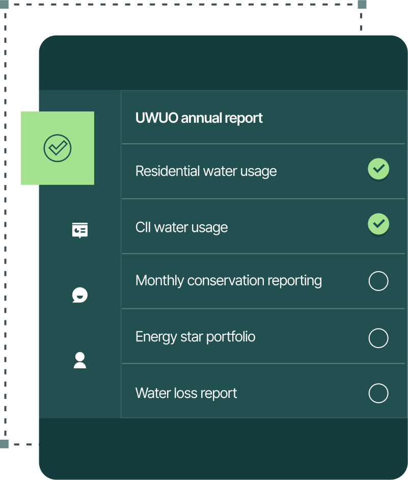
Every urban water supplier is now required to report annually
We make compliance management and filing easy by making sure you’re prepared with our detailed checklist & hands-on guidance that helps you.
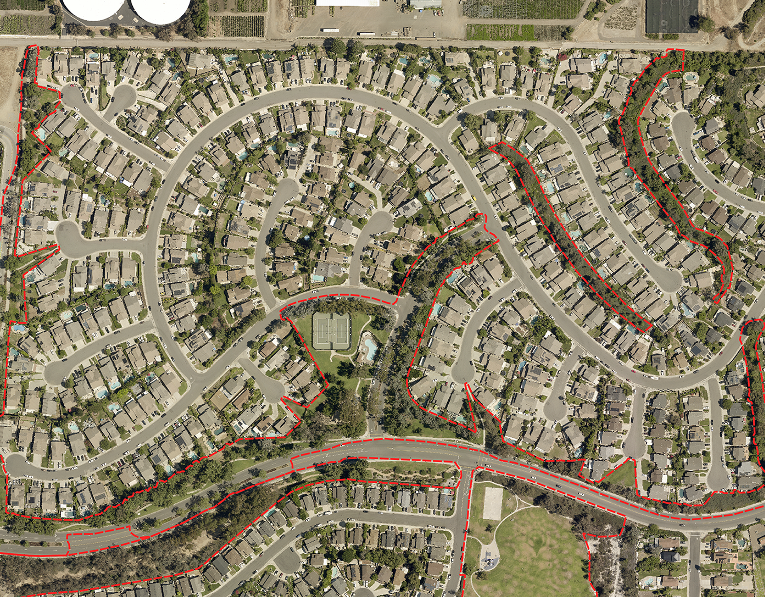
Creating state-mandated boundaries around your dedicated irrigation meters is one of the most costly steps
Accurately define your dedicated irrigation meter boundaries remotely in 95% of cases, eliminating the need for site visits. Efficiently clustering DIMs saves time, cuts costs, and further reduces on-site assessments, making compliance seamless and cost-effective.
Impact Studies
See how the water industry succeeds with Eagle.
View All Impact Studies
Learn how combining multiple data sets in WaterView could have saved this water municipal water district $60K