
Navigate all your state-provided data
The CalWEP LAM Explorer powered by WaterView is a free tool designed to help urban water suppliers comply with California’s Making Conservation a Way of Life regulations
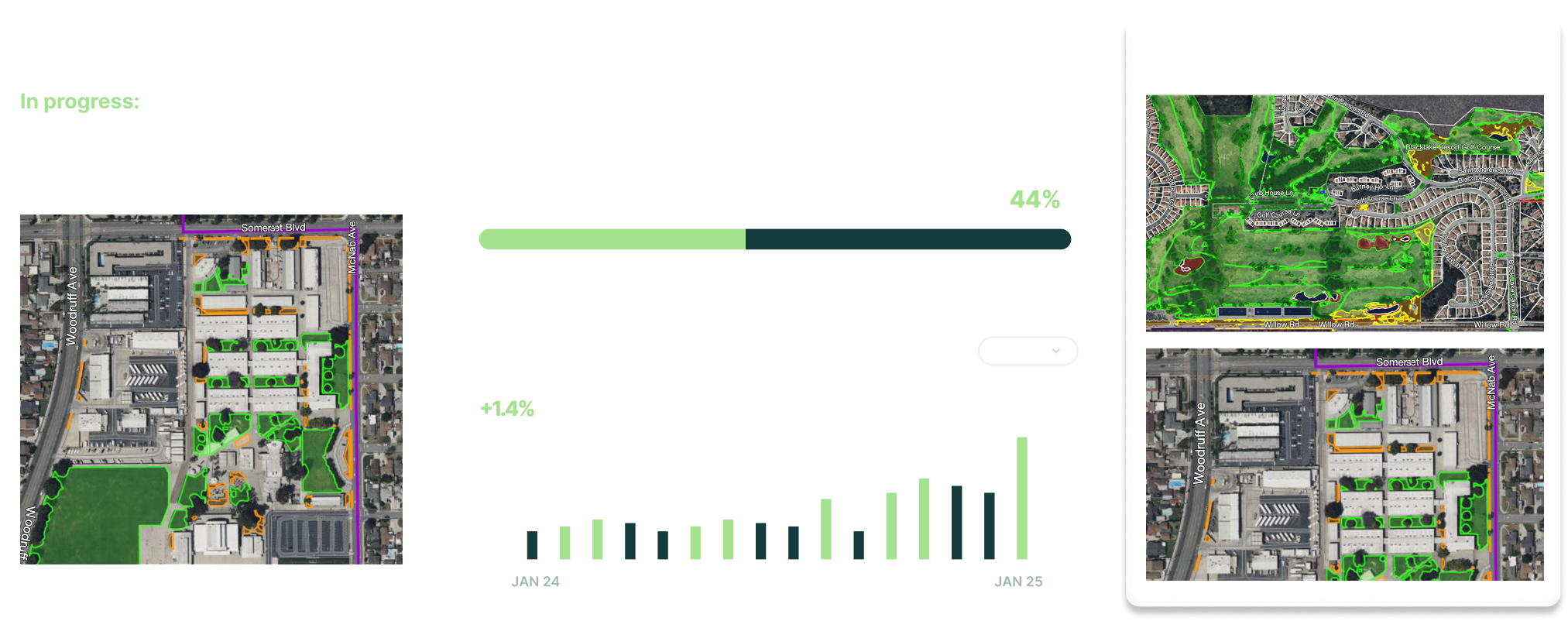
All state provided data
Visual viewer
Identify NFT
Consolidate and export data
Take compliance action steps
LAM Explorer Resources
The CalWEP LAM Explorer consolidates the state-provided residential and commercial LAM data, allowing you to view, navigate, query, and download your data.
Frequently
Asked Questions
Still have a question in mind? Contact us directly.
The CalWEP LAM Explorer Powered by WaterView is a free tool designed to help urban water suppliers comply with California’s Making Conservation a Way of Life regulations. It consolidates the state-provided residential and commercial LAM data, allowing you to view, navigate, query, and download your data. Even if you have GIS, this is an easy way to view and work with the data yourself without relying on the GIS department and tools, meaning you can take action on compliance requirements with the CalWEP LAM Explorer.
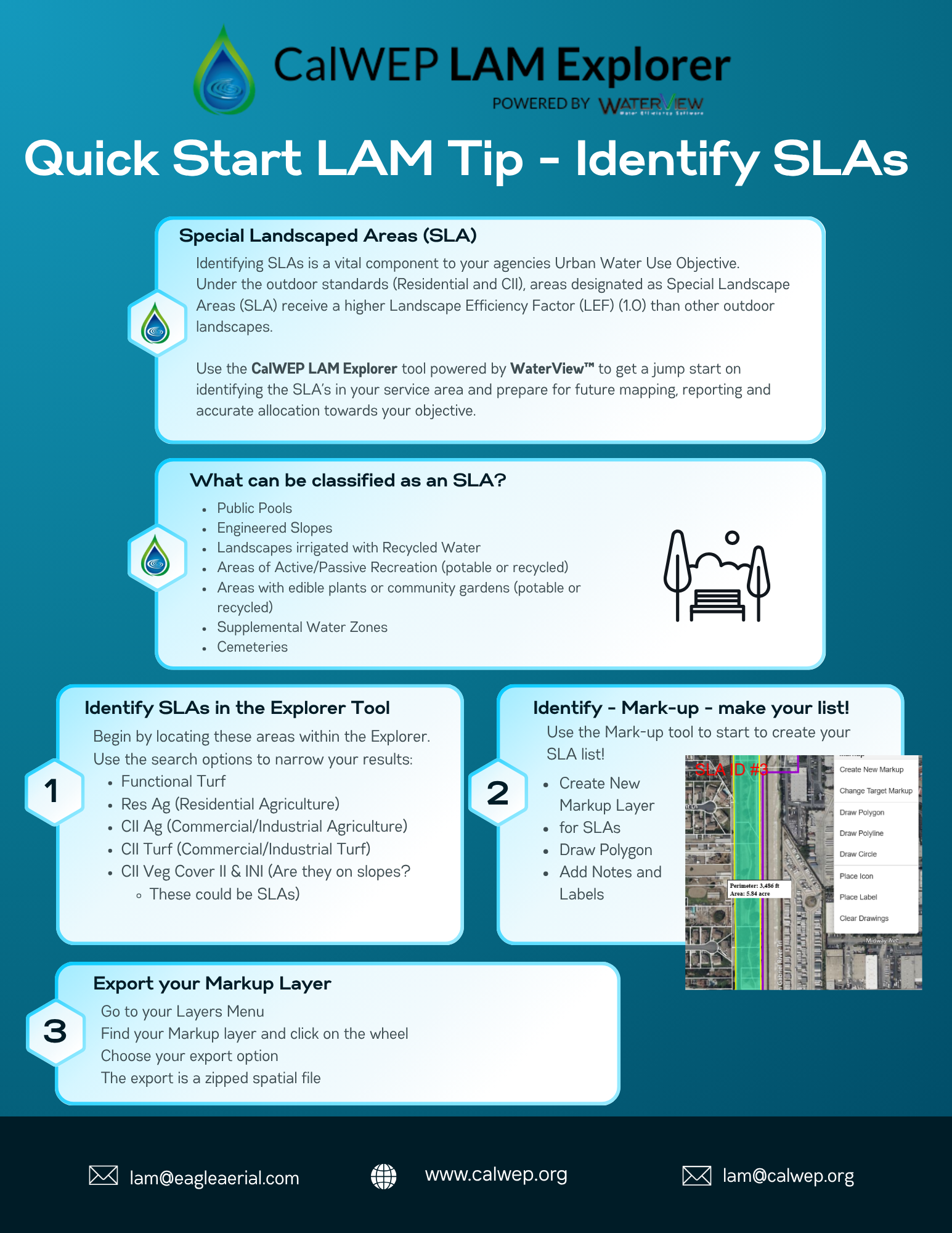
Here’s what you get and can take action on with the CalWEP LAM Explorer:
Data files consolidated: Get all state provided data files consolidated in one place. This goes beyond the CII LAM data you have received—or will receive—from the state, which is delivered in several separate files.
One place to work with all your data including 2018 imagery, res LAM data, 2020 aerial imaging, CII LAM, parcel data, original res LAM, and original CII LAM. Get a suite of tools that let you view, navigate, query, and download your agency’s LAM data.
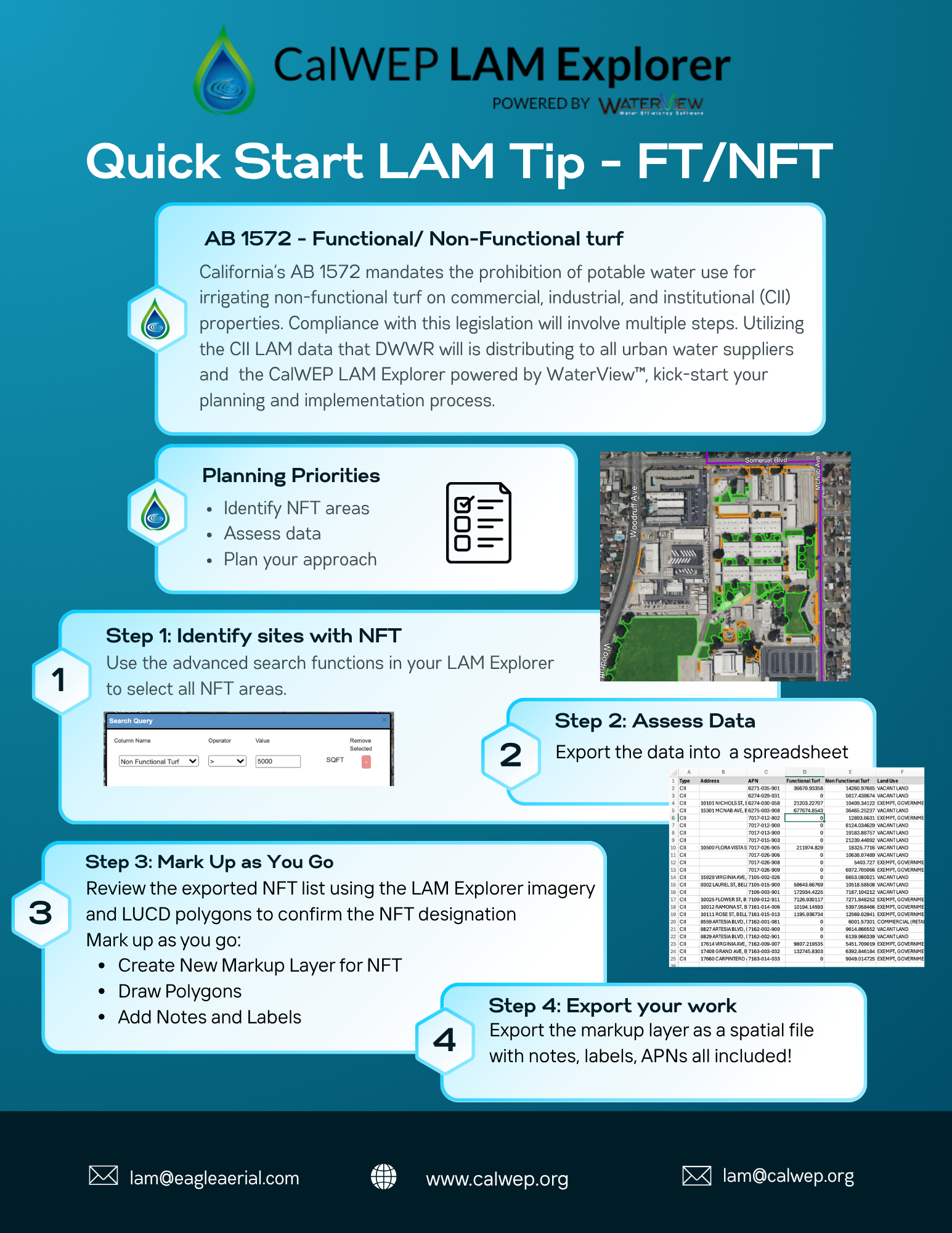
Visually view the identified non-functional turf for your agency, which helps you move forward with complying with AB1572 by notifying the identified customers/property owners about which areas are non‐functional turf and need conversion or irrigation via recycled water instead of potable water.
Visually navigate your agency's LAM data to validate the accuracy the state has to ensure you aren’t missing allocation due to inaccuracies, such as boundary lines, or misclassified parcels. For instance, with a visual view, it’s typically easy to spot if vacant land has been misclassified as institutional.
Urban water suppliers can register on our partner CalWEP's website to access the CalWEP Viewer.
Please note: Account creation is only available after DWR releases your CII LAM-LUCD data. Once you sign up, Eagle Aerial will upload your state data to the Explorer and notify you with your login credentials.
The California Department of Water Resources (DWR), in collaboration with NV5, developed the conditional Commercial, Institutional, and Industrial landscape area measurement and land use classification dataset (CII-LAM-LUCD).
This dataset helps urban retail water suppliers comply with the Water Code in three main ways:
Conditionally Classifying CII Landscapes: Assists in classifying irrigated CII landscapes, which may or may not be on a dedicated irrigation meter or associated with a CII large landscape irrigated by a mixed-use meter (Water Code Section 969(a) and Section 973).
Verifying Residential Extensions: Provides a dataset of residential extensions for suppliers to confirm—these are irrigated landscapes outside of a property line that may be irrigated by a residential customer. After confirming these extensions are irrigated by a residential customer, suppliers can request the State Water Board to include them in their Residential LAM estimates (Water Code Section 968(a)).
Identifying Nonfunctional Turf: Helps suppliers get started on identifying CII nonfunctional turf that may be irrigated with potable water (Water Code Section 10608.14). DWR is providing the CII-LAM-LUCD data as a starting point for urban water suppliers to evaluate CII outdoor water use efficiency, identify opportunities for conservation, and support compliance with the State Water Board's Making Conservation a California Way of Life regulations.
Eagle Aerial is the CalWEP partner of the year, 2026
We co-created foundational state data that enabled fair allocation for all 400+ urban water suppliers
Eagle, together and its partner, NV5 (formerly Quantum Spatial), are the companies that conducted the statewide Landscape Area Measurement (LAM) project for the California Department of Water Resources.
The LAM dataset produced by Eagle and NV5 on behalf of DWR has been provided to each 400+ California urban water suppliers, free of charge.
The Eagle/NV5 team includes multiple PhD-level remote sensing analysts whose skill has been required to develop this methodology over many years, in conjunction with the DWR team.
Get in touch
Let's connect you to an expert at Eagle
